

Comprehensive framework for the assessment of multi-level pluvial flood risk
This study outlines a comprehensive, multi‑level framework for assessing pluvial flood risk in urban areas, placing disaster risk reduction at the centre of its approach.
This study outlines a comprehensive, multi‑level framework for assessing pluvial flood risk in urban areas, placing disaster risk reduction at the centre of its approach.
EW4All held national consultative workshops in DR Congo and Malawi, bringing government and partners together to identify gaps, coordinate stakeholders, and develop national roadmaps to strengthen early warning systems.
The UN Emergency Relief Coordinator arrived in South Sudan on Friday to visit one of the most under-reported humanitarian crises in the world, as clashes between government and opposition forces continue in Jonglei state.
Solar-powered open-air cooling shelters can strengthen urban resilience to extreme heat by providing low-energy, outage-resilient relief, as shown through a pilot initiative in Philadelphia’s Hunting Park neighborhood.
A Turkish meteorologist has developed an early warning system that can detect sudden-onset weather hazards up to 60 hours before they occur, a breakthrough that could strengthen disaster preparedness and reduce economic losses linked to extreme weather.
This place-based case study explores how heat manifests in an urban context through a systems lens, examining interconnected roles. A fictional family narrative runs alongside the analysis, bringing systemic risks to life.
Chikungunya virus, a debilitating tropical disease caused by infected mosquito bites, poses a greater health threat in Europe than previously thought because it can be spread when air temperatures are as low as 13 degrees Celsius.
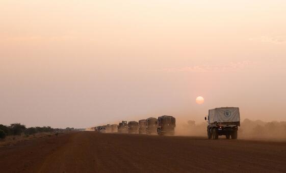
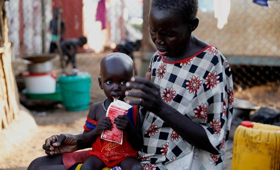
The UN World Food Programme (WFP) is scaling up its emergency response in South Sudan’s Jonglei state, where escalating conflict has displaced hundreds of thousands of people and pushed hunger to critical levels.
This report examines heat risk through the intersection of hazard, exposure, vulnerability and capacity, showing how impacts emerge across health, infrastructure, livelihoods and essential services.
This exercise will take place from 3 to 24 March 2026, bringing together scientific institutions, national authorities and civil protection partners to strengthen early warning systems and emergency response capacities.